

About Capitol Reef National Park
Capitol Reef National Park is located in south-central Utah within the Colorado Plateau. The spectacular geologic scenery and long cultural history of the area, along with ardent supporters, led President Franklin D. Roosevelt in 1937 to designate Capitol Reef National Monument. Congress established Capitol Reef National Park in December 1971. The park encompasses approximately 242,000 acres of rugged bedrock heights dissected by deep canyons, mesas, and buttes, and sparsely vegetated badlands. These striking features are unified by the nearly 100-mile-long monocline (wrinkle in the earth’s crust) called the Waterpocket Fold. The park’s varied landscape is the result of 270 million years of geologic history and an abundance of colorful Mesozoic Era strata. The exposed geologic strata reflect the stories of changing ancient oceans, swamplands, riverine environments, desert climates, and volcanism.
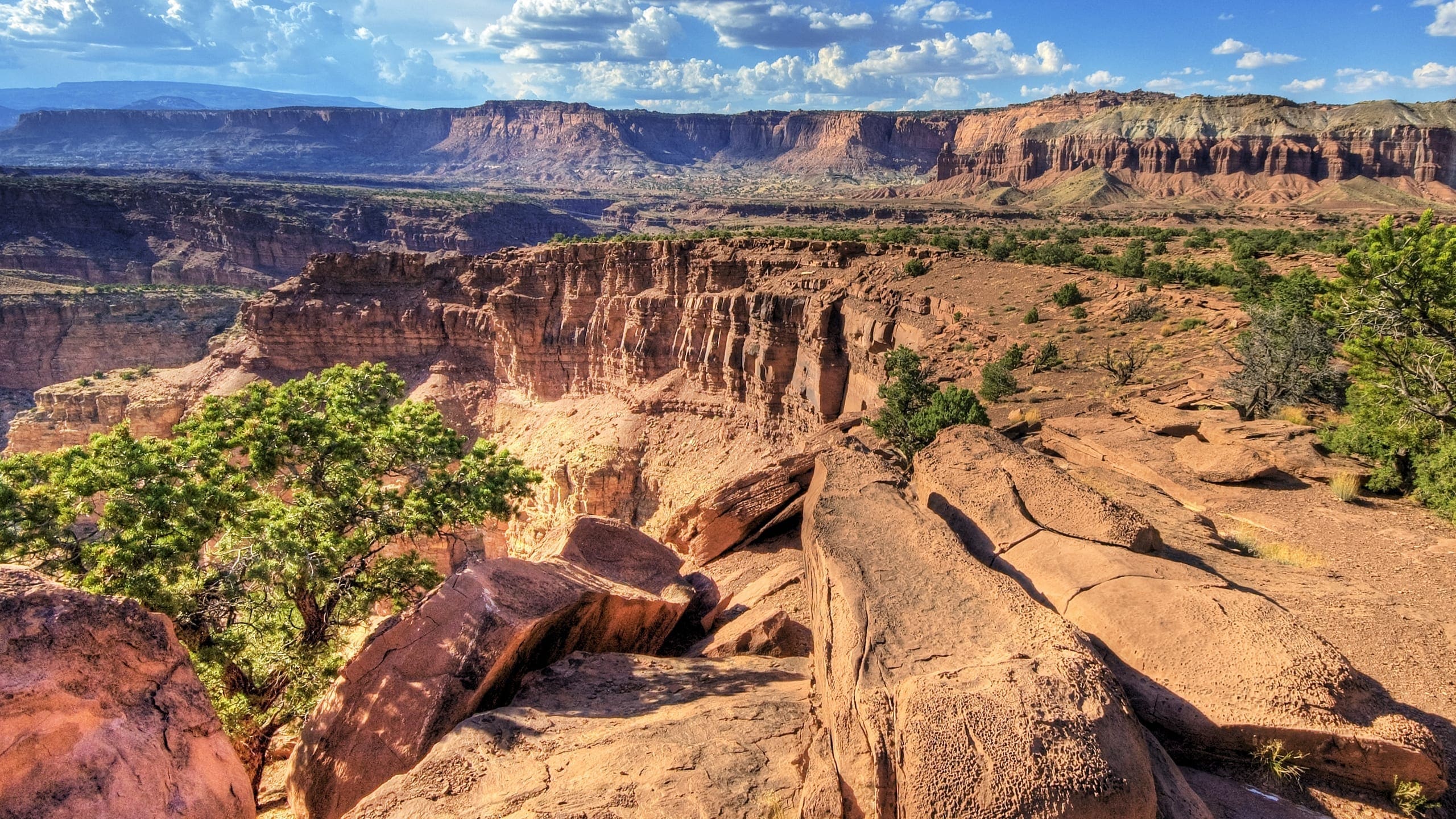
The Waterpocket Fold is the classic definition of a monocline, a geologic fold with steeply inclined layers that create a warp, or step, in otherwise relatively horizontal layers of rock strata. The exposed Waterpocket Fold in Capitol Reef National Park is the largest monocline in North America and results from movement along faults deep in the Earth’s crust. Geologic layers on the west side of the fold were lifted more than 7,000 feet higher than the respective layers on the east. The fold formed between 70 and 35 million years ago as part of a major mountain-building event in North America known as the Laramide Orogeny. Within the last 20 to 5 million years, continued uplift of the Colorado Plateau, combined with erosion, exposed this fold to the surface. The Waterpocket Fold was named for the many water-holding basins created in the exposed bedrock of the fold. The high rugged cliffs of the Waterpocket Fold appeared to early explorers and pioneers as a difficult barrier to cross, likened to a reef at sea, and this reef-like barrier helped give the park its name.
The southern section of the park, known as the Waterpocket District, provides superb opportunities to view and explore the Waterpocket Fold. Traveling the Burr Trail and Notom-Bullfrog Roads, visitors pass mile after mile of spectacular cliff faces, amphitheaters, strike valleys, narrow canyons such as Upper and Lower Muley Twist, and other geologic wonders.
Visitors who venture to the remote northern sections of the park, called the Cathedral District, are rewarded with spectacular vistas, and views of massive solitary sandstone monoliths standing in stark contrast over the vast desert landscape. The Temple of the Sun and Temple of the Moon monoliths are emblematic of the park.
The most visited areas of the park and most easily accessed, the Fruita Rural Historic District and nearby areas, were occupied both prehistorically and historically. Prehistoric peoples of the Archaic and Formative periods traveled through and lived in Capitol Reef, including the Fremont River valley and nearby stream valleys. Modern archeologists call the American Indians of the Formative period the Fremont Culture, based on work conducted along the Fremont River. These relatives of Ancestral Puebloans migrated out of the area around AD 1300, leaving behind petroglyphs and pictographs on rocks and canyon walls to mark their passage. In the early 1600s to 1800s, Paiute Indians lived and thrived in the area. Early explorers, Mormon pioneers, and others came to the area in the late 1800s and named Chimney Rock, Hickman Bridge (a natural arch spanning 133 feet and 125 feet tall), Capitol Dome (a large sandstone feature that also contributed to the park’s name), and other features throughout the park. The historic Mormon farming community of Fruita was occupied and actively farmed from the 1880s through the 1950s. Most private lands in Fruita were purchased in the 1960s, and by the time Capitol Reef was designated a national park in December 1971, little private land remained in Fruita. Substantial remnants of the extensive pioneer orchards are still managed by the park, and many of the historic buildings remain.
The gateway town of Torrey, 11 miles west of Capitol Reef National Park visitor center on Utah Highway 24, offers lodging, restaurants, and other services, and easy access to the scenic wonders inside the park. Other neighboring communities near the park, including Teasdale, Bicknell, Lyman, and Loa west of the park and Hanksville east of the park, make great staging areas for exploration of Capitol Reef National Park and the surrounding area.
Source: Foundation Document – Capital Reef National Park
Fast Facts:
| Date the Park was Established: | December 18, 1971 |
| Park Area (as of 2019): | 241,904.50 acres (979.0 km2) |
| Recreational Visitors (2018 Total): | 1227627 visitors |